Munda Biddi Trail – Trail Improvement Project
We acknowledge the Noongar people as the Traditional Owners of the land through which the Munda Biddi trail passes.
Significant upgrades and maintenance works continue on Western Australia’s long trails; both the Bibbulmun Track (read more about the Bibbulmun upgrades here) and the Munda Biddi Trail have received upgrades and maintenance from the Parks and Wildlife Service of the Department of Biodiversity, Conservation and Attractions (DBCA), and volunteers, to maintain their world class status.
Volunteers, deployed by both the Bibbulmun Track and Munda Biddi Trail Foundations continue to play an important role in constant small maintenance tasks that are a daily occurrence. From things like an ‘eyes on the ground’ program that documents tasks to be done, to significant fallen tree removable by chainsaw, to complete realignment, sometimes by kilometres, volunteers are indispensable in keeping the tracks and trails in great shape. Increasingly, highly skilled and trained volunteer crews are also undertaking more complex and difficult projects.
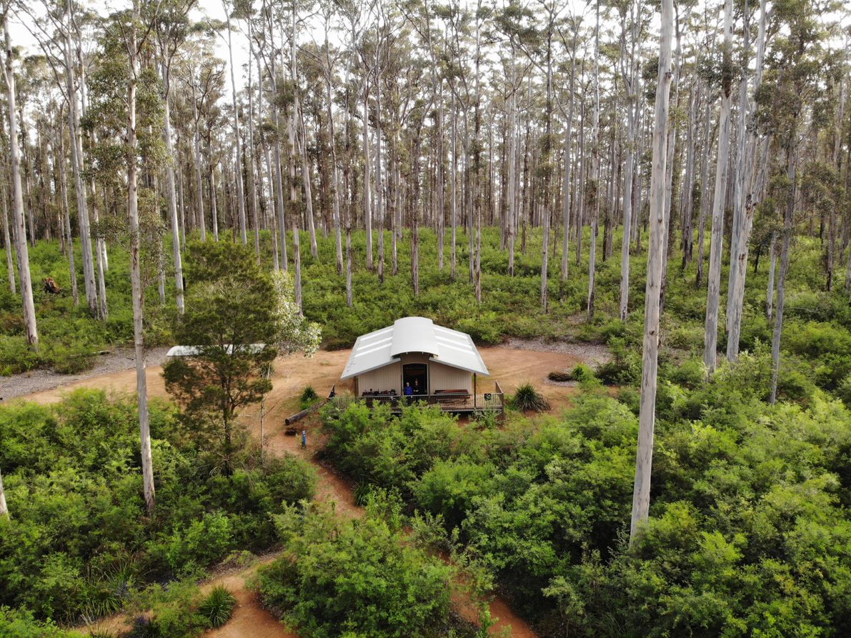
The Munda Biddi is a unique trail, one of a kind in the world, particularly when considering its length at 1,060km. Rather than thinking of it as a mountain bike trail, think of it as a long-distance, predominantly off-road cycle experience. Strategically aligned to pass through 15 small towns in southern WA there are also 12 purpose-built campsites, with facilities including shelters, picnic tables, toilets and water tanks.
Southern Realignments
Over the past year three significant realignments and upgrades have been completed on sections in the southern half of the Munda Biddi as part of the Great Southern Adventures Trails Project funded though the WA Recovery Plan.
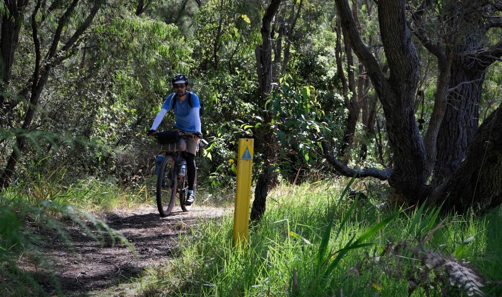
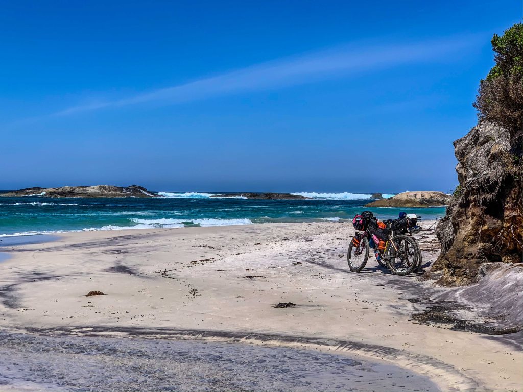
The realignment of the Munda Biddi off Rate Road
The first section to be completed was a 4.8km section of single track that realigned this section of the Munda Biddi off Rate Road and through a beautiful part of the Valley of the Giants tingle and karri forest.
This scenic alignment takes in some key points of interest, makes it a beautiful place to be and a very enjoyable ride through the tingle forest.
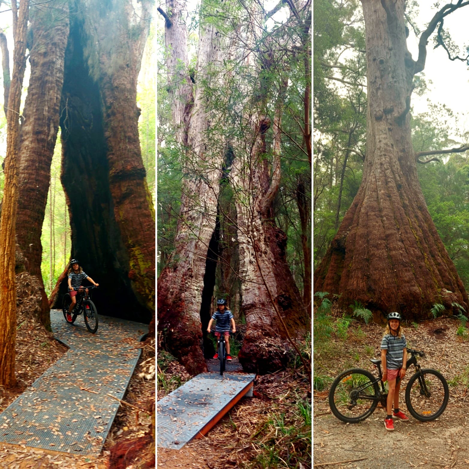
It includes the iconic ‘Ride Through Tree’, a massive tingle tree with a hollow at the base big enough to ride your bike through. The designers have created a carefully constructed trail that does not impact upon the root system of the tree and preserves its integrity. It is an iconic moment for riders on the Munda Biddi.
A series of switchbacks have been built to assist in the ascents, but also to slow the descents. They are gently banked to provide safety and ease of passage and limit the amount of braking required. Minimising skidding will ensure a sustainable and long-life trail.
Rate Road will become the new access road to the trail head for the Valley of the Giants trails network, complete with sealed car parking and toilet block. This will relieve the pressure on the Tree Top Walk car park and other facilities.
Visit alerts.dbca.wa.gov.au for up-to-date information or alerts. For a map of the Valley of Giants realignment visit the alerts page here.
Ride through Tree Photo credit Peter Worthington (DBCA)
Albany Windfarm realignment
This realignment now takes Munda Biddi riders off the sometimes-busy Lower Denmark Road. Instead of traffic, riders can now enjoy some unique coastal bushland, crossing areas subject to winter inundation that required 48 metres of elevated platform to keep the trail above the water. Fiberglass Reinforced Plastic (FRP) decking panels on concrete footings were used as they are very robust and resistant to water damage.
The 48-metre elevated trail platform allows riders to traverse a small, but important, area near Lake Powell, protecting the sensitive wetland area.
The entire 21.1km section had a comprehensive planning and design process with input from the traditional owners, consultation with nearby residents, flora and fauna surveys, consultation with the City of Albany, coordination with Synergy as the owner of the Albany Windfarm and liaison with the Water Corporation due to the proximity of drinking water bores.
The project team rose to the occasion, managing this complex site and constructed excellent hardened natural surface, single track through some of the most spectacular scenery on the South Coast.
For a map of the Albany Windfarm realignment, visit the alerts page here.
For more details visit the Trails WA Projects website newsletter here.
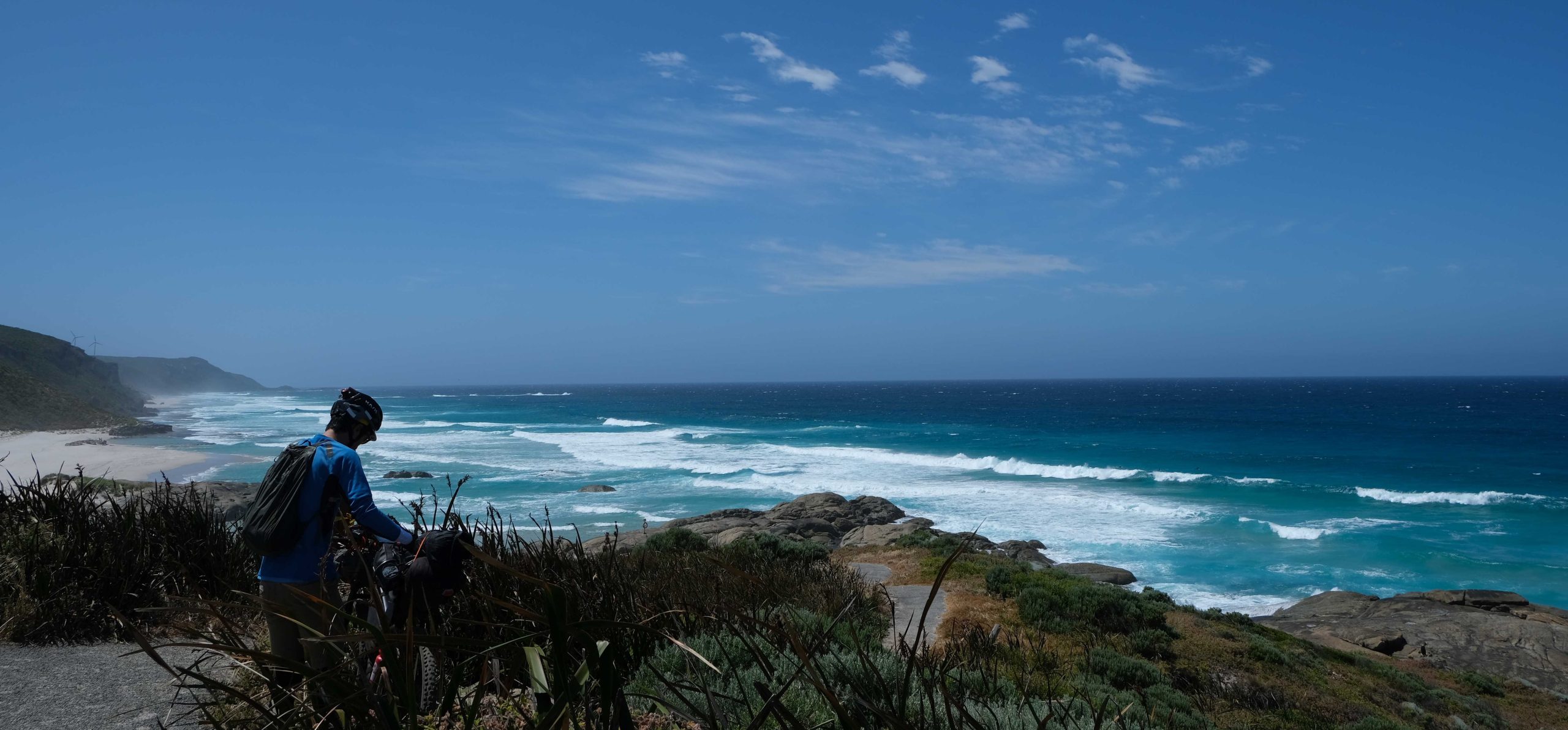
Wilderness Ocean Walk (WOW) Stage 2 extension Denmark Windfarm to Sinker Bay
Funding from the WA Recovery Plan, through DBCA, has enabled the Stage 2 extension of the popular dual use Wilderness Ocean Walk (WOW) trail, from the Denmark Windfarm to Sinker Bay.
This new 3.23km trail extends and links into William Bay National Park connecting the Bibbulmun Track and provides part of the Munda Biddi Trail alignment (new works completed in 2021/22). In the broader setting of trail opportunities, it will provide an expanded coastal trail network in the Denmark area.
The extension of the WOW trail will provide extensive uninterrupted views over the ocean and headlands, continuing the coastal experience for local residents and visitors alike.
This coastal dual use (walk and cycle) trail is designed to link the Denmark townsite to Lights Beach once complete, providing economic flow on effects to local communities through promotion of additional sections of the WOW trail and potential extended stays/hire opportunities.
This is a jointly managed project with DBCA in partnership with the Shire of Denmark and Windfarm Community. The project will apply DBCA’s standard project management approach, the WA trail development guidelines for trail design and construction, use of the Disturbance Approval System (DAS) which incorporates flora/fauna, dieback and traditional owner considerations. These processes also capture planning and approval requirements specific to local government.
Lastly, this project is consistent with the strategy to look for future opportunities to take sections of the Munda Biddi Trail off bitumen roads or vehicle tracks and improve trail user safety and visitor experience.
You can keep up to date with the progress of the WOW Stage 2 trail implementation through the Shire of Denmark community website, Your Denmark here.

Northern Section – Munda Biddi realignments
The upgrades and realignments have not just been confined to the southern half of the Munda Biddi; parts of the northern Munda Biddi Trail have also received attention.
In fact, even during COVID-19, there have been multiple upgrades in the northern parts of the trail between Mundaring and Collie. Most have made it into the latest reprint of the Munda Biddi maps, which were reprinted in July 2021.
Utilising WA Recovery Plan funding of $195,000, plus a Forest Enhancement Fund Grant of $30,000 combined with internal funds from DBCA, eight projects were completed to upgrade and realign sections of the Munda Biddi.
Some, like the realignments near the Perth Observatory in the Korung National Park, are relatively short at only 800m and 1200m respectively, however they sympathetically follow the contours of the slope and provide a better alignment and minimise erosion.
Even the start of the trail in Mundaring townsite has received attention with 1.6km of new alignment that has taken the trail off Mundaring Weir Road and on to some dedicated single track.
One of the longer northern realignments at 2.4km is in the Monadnocks Conservation Park close to the upper reaches of the Canning River. If coming from the north, the old alignment of the trail from the ridgeline to the river valley across the Canning River was a steep, downhill run causing erosion on the trail by riders having to brake hard. If coming from the south it was a steep, rutted uphill climb.
By using the contours of the landscape, constructing switchbacks and installing drainage swales the trail is much more suitable for bikes and riders carrying a load.
In September 2022, the Munda Biddi’s alignment north and south of the Dwellingup town site was upgraded to incorporate the new Dwellingup Town mountain bike trails that had been constructed. You can see the new 4.7km northwest alignment on this map on the Park Alerts page here
On the southern side of Dwellingup, another realignment of 1.1km was completed in the same month. This realignment took the Munda Biddi off River Road and on to single track making it safer for riders. You can see a map of the new alignment here.
Outside of Dwellingup in the popular Lane Poole Reserve there has been a small 200m realignment allowing the Munda Biddi to pass through the trail head for the new Murray Valley MTB trails. Toilet facilities are accessible from the trail head. More information is available on the Alerts page here.
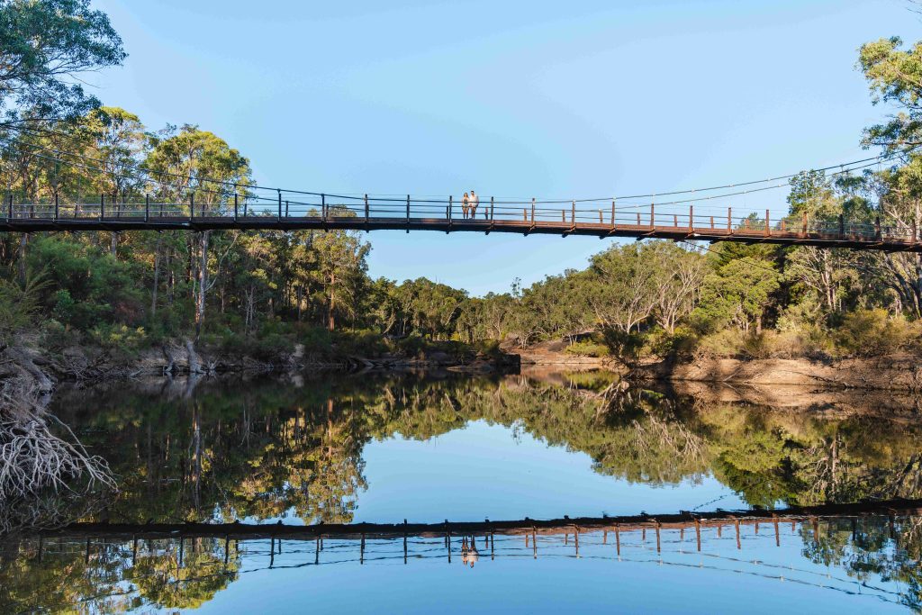
The biggest news, and the most impressive realignment, is the addition of the new Dwaarlindjirraap Bridge across the Murray River from the Lane Poole campground to the Murray Valley MTB trails on the southern side of the river. While the trail leading up to both sides of the bridge is a temporary diversion for now, it’s envisaged that new trail, catering to the needs of campers and mountain bikers, will be constructed soon. View the map of the diversion here.
The Dwellingup Adventure Trails project was the major source of funding for the bridge project and for the two realignments either side of Dwellingup.

At 108m in length, the Dwaarlindjirraap Bridge is an amazing piece of infrastructure that affords magnificent views up the river over Baden Powell Waterspout and down the river towards Nanga Road. The bridge links up the 1.97km realignment, and the other trail networks in the area and facilitates bikes staying off the busy vehicle roads like Nanga Rd. You can read more about that here.
The final northern Munda Biddi realignment is part of the Collie Adventure Trails network and the longest realignment at 19.2km. The Munda Biddi trail now runs directly into the Collie townsite, instead of being a spur trail into town.
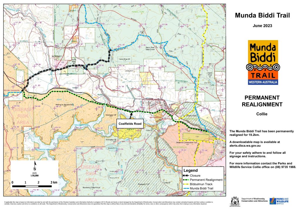
If coming from the north, there is new trail that now comes from east of Wellington Dam crossing over the northern arm of the water body and runs along the northern edge of the Wellington National Park before heading directly into Collie. This parallels the Coalfields Hwy now making Collie a favourite place for thirsty and hungry riders to stay.
Heading south, the trail then exits town along the original spur trail from Collie on a mixture of dedicated single track and sealed dual use paths. See a map of the Collie realignment here

Munda Biddi Foundation
The work of trail maintenance, and searching for better alignments, will be an ongoing task keeping DBCA staff and Munda Biddi Foundation volunteers engaged and busy into the future. You can help keep the Munda Biddi at its world class status by joining the Foundation and volunteering on a section. Click here to learn more about Volunteering at the Munda Biddi Foundation, or the link below will take you to the Munda Biddi website to contact the Foundation and to learn how you can get involved.
Share This Post
More To Explore
Recent Posts

© Trails WA Projects 2025